MADIS
The Ocean, Measured in Real Time
Marine Analysis Data Intelligence System – every AQVARIX-equipped vessel becomes a permanent ocean sensor node, streaming validated met-ocean data from where it matters most: the sea itself.
WHY OCEAN DATA
Decisions at Sea Are Only as Good as the Data Behind Them
IN-SITU ACCURACY

Wave-height correlation against Central Weather Administration reference buoys.
ALWAYS ON

Every equipped vessel streams wave, current, depth and weather data on every voyage.
NETWORK EFFECT

Each new vessel expands coverage — more ships, more data, better forecasts for everyone.
CAPABILITIES
Multi-Parameter Observation Suite
Wave Dynamics
Significant wave height and period derived from accelerometer/IMU via RAO correction algorithms.
Ocean Currents
Velocity profile measurements using ADCP DCPS 5400 for current speed and direction.
Atmospheric Data
Wind speed, direction, and barometric pressure from GMX500 multi-sensor weather station.
Bathymetry
Real-time depth detection using DST 800 single-beam echo sounder.
Sea Temperature
Surface and subsurface water temperature monitoring with precision sensors.
HOW IT WORKS
From Hull to Insight
Collect — Ships as Sensor Nodes
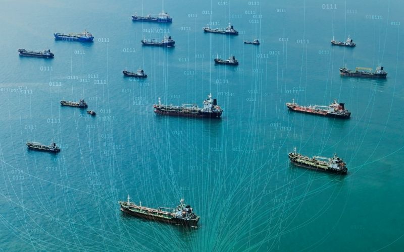
Every AQVARIX vessel doubles as a MADIS node, measuring waves, currents, depth, temperature and weather along its route — no extra crew workload, no dedicated survey vessel required.

Validate — MCC + GenAI Quality Pipeline
Raw readings are cleaned, cross-checked and validated through our MCC + GenAI pipeline, so what reaches you is analysis-ready data you can trust — not noise.
Deliver — Data Where You Work
Access continuous streams via API and dashboard, commission scoped surveys, or license historical datasets — for forecasting, offshore wind, port operations and maritime AI.
HOW IT WORKS
From Hull to Insight
Collect — Ships as Sensor Nodes
Every AQVARIX vessel doubles as a MADIS node, measuring waves, currents, depth, temperature and weather along its route — no extra crew workload, no dedicated survey vessel required.
Validate — MCC + GenAI Quality Pipeline
Raw readings are cleaned, cross-checked and validated through our MCC + GenAI pipeline, so what reaches you is analysis-ready data you can trust.
Deliver — Data Where You Work
Access continuous streams via API and dashboard, commission scoped surveys, or license historical datasets — for forecasting, offshore wind, port operations and maritime AI.
VALIDATION
Proven Performance: In-Situ Testing
Test Campaign
- 75+ hours of offshore operations
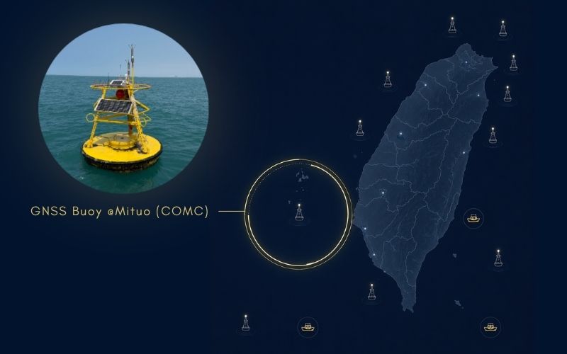
- Mituo & Xiaoliuqiu buoy areas
- Medium to rough sea conditions
- 100% data acquisition rate
Benchmarked against Taiwan’s Central Weather Administration buoy network through a 24-month partnership — 23 reference buoys around Taiwan.
Wave Height (Hm0)
Correlation vs CWA buoys · RMSE 0.93 m
Water Temperature
Excellent correlation with reference stations
Wind Speed
Strong correlation – atmospheric accuracy
%
System Reliability
Complete data capture across all deployments
Powered by data. Designed for safety. Trusted to save lives and prevent loss.
WORKING WITH US
Three Ways to Put MADIS to Work
Project-Based
Scoped data programs
For governments, ports, offshore wind & cable operators
Survey and monitoring campaigns designed around your site
Milestone-based delivery with analysis & reporting
Custom sensor mix and coverage area
DaaS | Data as a Service
Subscription access
For fishery boards, weather agencies & research institutes
Continuous met-ocean data streams, QA-validated
API & dashboard delivery, analysis-ready
Proven in a 24-month CWA partnership
Grows with the vessel network. Coverage keeps improving
License
Enterprise data licensing
For unmanned-vessel OEMs, climate tech & reinsurance
Historical + live dataset licensing
AI-training-ready maritime data
Flexible B2B / B2G terms per use case
Partnerships & Key Collaborations
Our ecosystem is strengthened by collaborations across government, academia, and industry: